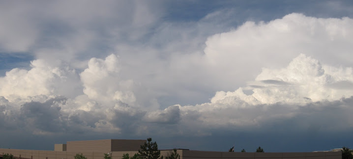
I went on my first solo storm chase on Sunday May 24th. I was heading home from church around 1pm, noticed that the skies were looking very ripe for storm development. Upon looking at a surface plot I noticed a convergence line that had setup in the Denver metro area and storms were firing off this line and propagating northeast. I made a quick look at updated imagery and decided to grab my gear and head out to try to catch some storms. As soon as I got the vehicle setup I noticed a tornado warning had been issued for the northern Denver area. This storm fired off the convergence line near Commerce City and rapidly developed into a rotating mesocyclone. A couple of colleagues were already northeast of this tornado warned cell and catching some amazing photos from it. I headed north on I25, then up on I76 to Hudson. Filled up on fuel and received an updated radar scan on GR from a wifi spot (Thanks Eric!). Decided to head east on Highway 52 trying to beat a 1.0” hail producing storm before it crossed the highway. I arrived in Prospect Valley at the intersection of Highway 52 and 79 with only experiencing heavy rain and small hail. I collected some photos and continued heading south on Highway 79 towards Bennett. From Bennett I headed east and stopped in Strasburg. I received several updated radar scans and collected some nice photos and video of the gust front shelf cloud advancing eastward. GR radar was showing a cell moving north towards Deer Trail so I set out to try to intercept. Arrived in Deer Trail but couldn’t get ahead of the storm so I changed course and continued to watch the shelf cloud rolling eastward and showing some small scale low level circulation. I watched this cell for awhile until it lined out, then decided to head back home and caught up with some other chasers for some dinner. Made for a great day with good photos and fun! Total Miles: 188 miles.
Pictures:


Video:


1 comment:
Glad you got out, hoss.
Post a Comment